stock here: just the way the clouds are forming is scary.
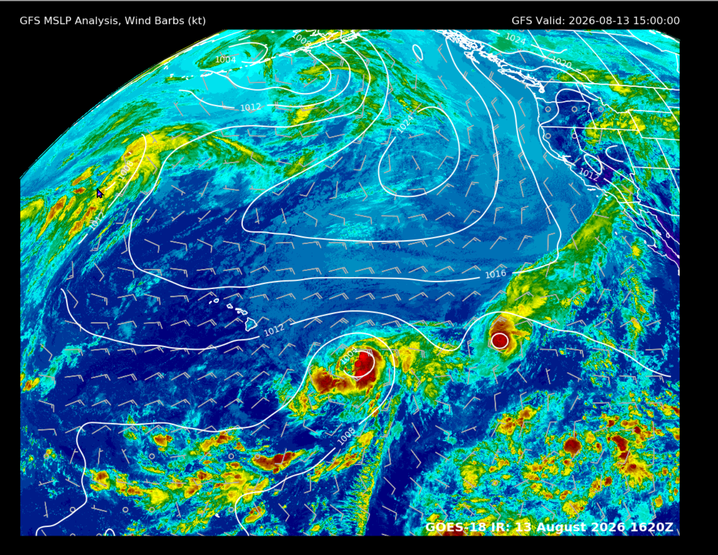
I pulled the current material. Your west / slightly south-of-west idea is supported, and the official NHC track discussion is now essentially saying the same thing.
At 1500 UTC Aug. 13, Tropical Storm Lala was near 15.2°N, 145.5°W, moving 280° at 9 kt — almost due west, with just a small northerly component at that instant. Maximum sustained winds were 35 kt.
More importantly, NHC’s current forecast has Lala approaching near or just south of the Big Island Saturday, potentially near hurricane strength.
On the atmospheric structure, I pulled the current GFS Central Pacific 850-mb, 500-mb, 200-mb and 200–850-mb shear products. Tropical Tidbits is indeed carrying all those fields specifically for Lala/01C in the current Aug. 13 run.
What I would take from the combined setup is:
- 850 mb: this is the important lower-level steering layer, and the subtropical ridge north of Lala is providing a strong easterly component. That favors westward motion.
- 500 mb: this tells us whether the ridge is vertically deep enough to steer a strengthening cyclone. At the moment the large-scale pattern is consistent with Lala continuing generally west rather than finding an obvious weakness and recurving north.
- 200 mb: mainly useful here for outflow and shear, rather than track by itself. The current GFS product set explicitly includes the 200–850 mb shear field, which is what I would watch for whether Lala can vertically stack and strengthen.
- NOAA’s Hawaii GeoColor loop is updating every 10 minutes, so the visible cloud motion is a very good reality check against the model fields.
So going back to your original picture: you were reading the overall pressure pattern correctly, even if technically the 1008 isobar isn’t “dragging” Lala. The broad ridge north/northeast of the cyclone is the steering mechanism.