stock here: I’ll have more on episode 55 also, Kilaeau eruption….
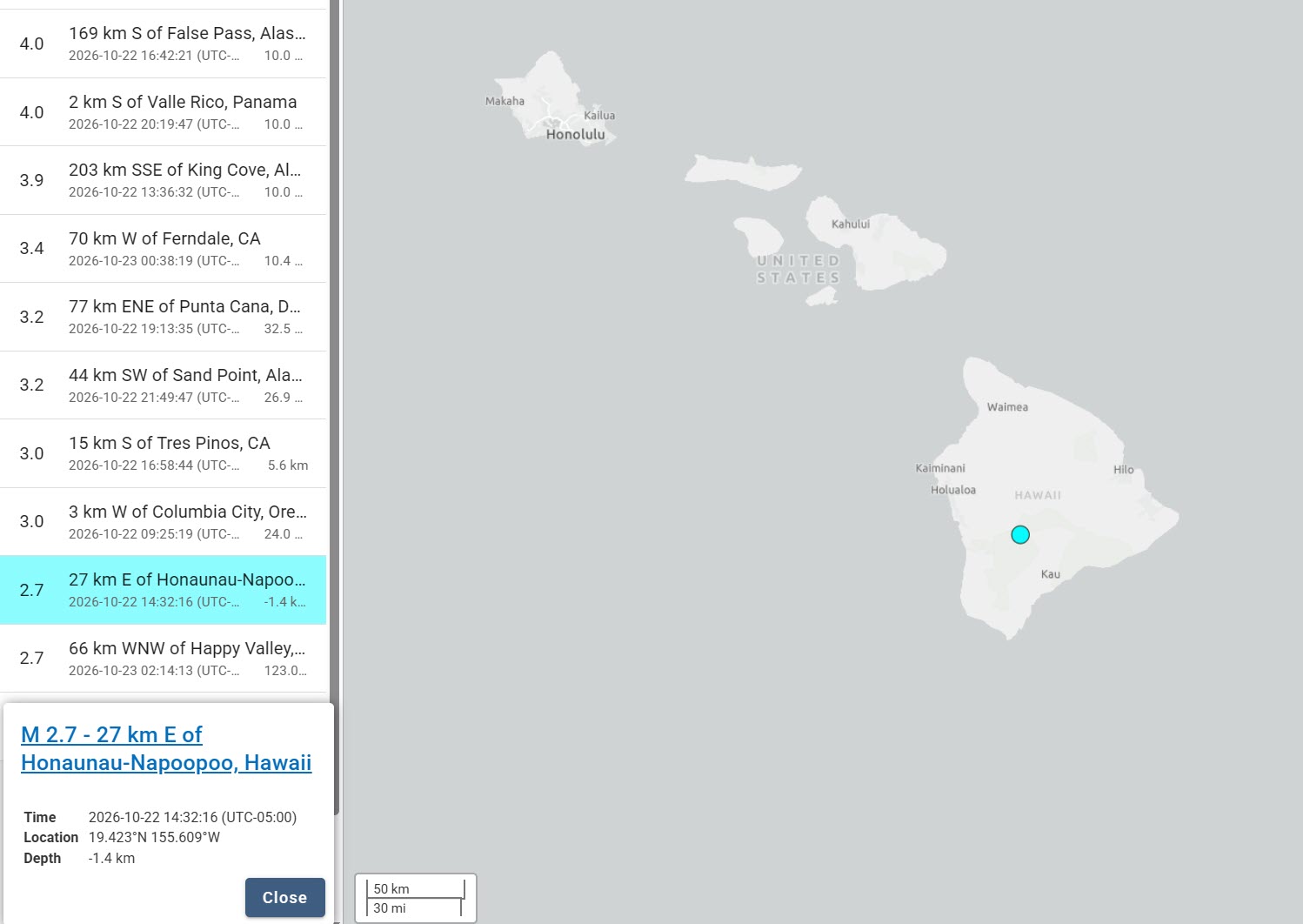
These high hits are sometimes just structural imbalances correcting themselves, and sometimes show magma moving. I used a slice and dice method in 2018 to map out the combined magma chamber of Mauna Loa and Kilaeau, and the upper Magma Chamber of Mauna Loa. It was tedious and super primative, but highly effective.
There is long, but very interesting description of the area below all the images. Curious the 1926 Aerial photography. At the bottom is a reference for a 103 page, LOL, hand typed report, for those who want to deep dive.
Mauna Loa summit: Understanding your labeled image
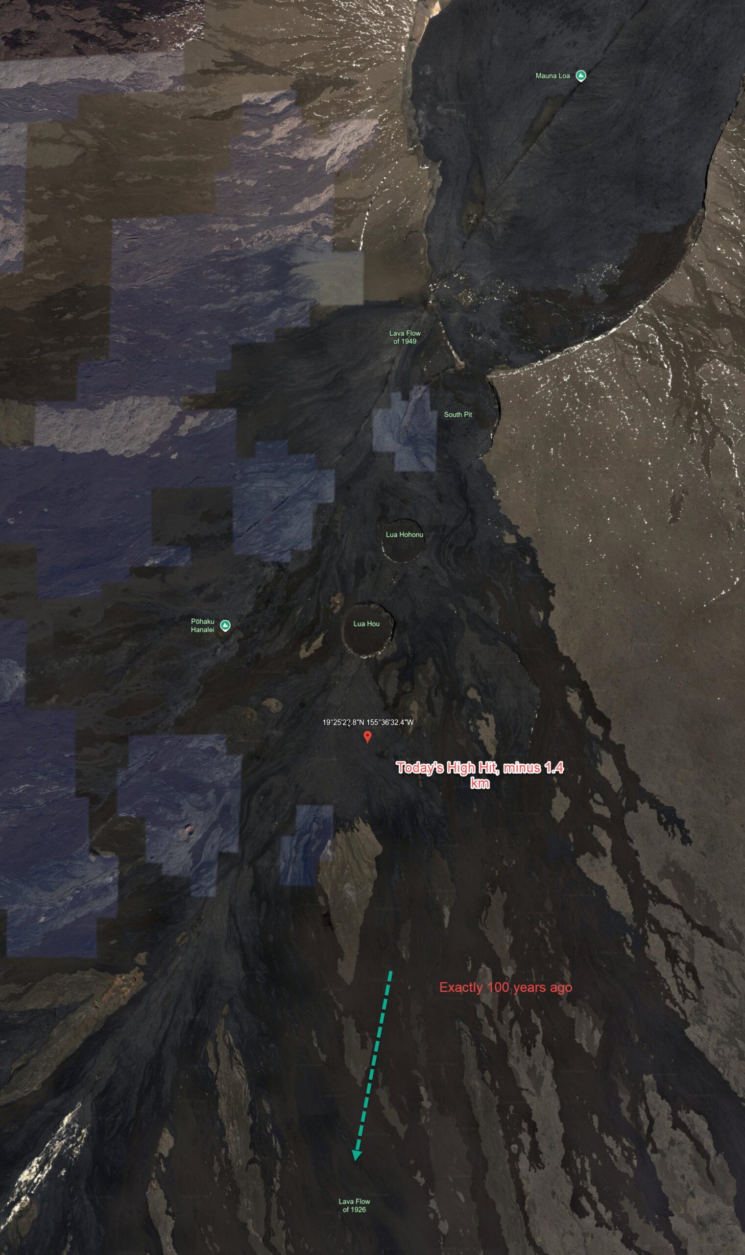
Your image captures one of the most geologically fascinating parts of Hawaiʻi: the summit of Mauna Loa and the beginning of its Southwest Rift Zone, where magma repeatedly fractures the volcano and creates new craters, fissures, and lava flows.
What’s especially interesting is that you’re looking at several different types of volcanic features formed by different processes, all within a relatively small area.
The 1926 and 1949 lava flows are particularly significant. The former was a destructive flank eruption, while the latter was primarily a summit eruption that dramatically modified South Pit.
1. The labeled features, north to south
| Label in your image | Geological significance |
|---|---|
| Mauna Loa | Massive active shield volcano, elevation approximately 13,679 feet (4,169 m). Its broad summit contains the Mokuʻāweoweo caldera. |
| Lava Flow of 1949 | Basaltic lava from the 1949 summit eruption. Lava cascaded into South Pit, eventually filling it sufficiently to overflow down the southeastern flank. |
| South Pit | A collapse-related pit crater at the southern end of the summit caldera complex. It was substantially modified and partly filled by the 1949 eruption. |
| Lua Hohonu | Hawaiian for deep pit. A distinct pit crater southwest of South Pit, associated with the summit’s extensional and collapse structures. |
| Lua Hou | Hawaiian for new pit. Another well-defined pit crater along the southwestward continuation of the summit fracture system. |
| Pōhaku Hanalei | A named summit-area rock/landmark southwest of the pit craters. Its precise geological origin is less clearly documented than the major craters. |
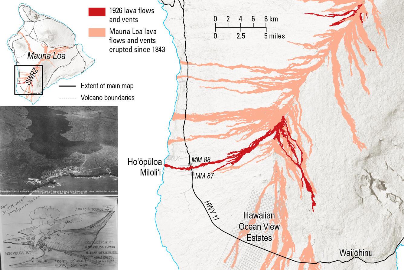
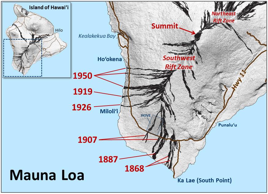
| Lava Flow of 1926 | The upper portion of lava associated with the April 1926 eruption, which migrated down the Southwest Rift Zone and ultimately destroyed a coastal village. |
The Smithsonian Global Volcanism Program independently identifies South Pit, Lua Hohonu, and Lua Hou as distinct pit craters.
Mauna Loa
+2
2. The pit craters: Why are there enormous holes in solid lava?
Your image nicely illustrates how these volcanic depressions align with the rift zone.
A pit crater isn’t necessarily formed by an explosive eruption. In basaltic volcanoes such as Mauna Loa, the process is often quite different.
Conceptual cross-section: withdrawal or redistribution of magma can remove support beneath the surface, allowing overlying basalt to collapse. Not a measured section of Lua Hou.
The mechanism generally involves magma draining or relocating within the volcanic plumbing system, fractures developing in the overlying rock, and blocks collapsing downward.
Importantly, Lua Hohonu and Lua Hou are not simply two small volcanic cones. They are depressions formed by collapse processes.
3. The 1949 eruption: Lava filling a crater

The 1949 eruption began on January 6. By January 23, lava fountains were reaching approximately 500 feet, with some bursts estimated above 800 feet.
Lava entered South Pit, progressively raising its floor. On January 25, it overflowed and traveled southeast, eventually reaching approximately 5.5 miles from the summit.
U.S. Geological Survey
In your image, the broad dark surface extending south from the summit is evidence of this relatively recent volcanic activity.
This illustrates an important point: lava eruptions can fill craters as well as create them. The shape of Mauna Loa’s summit is constantly being reconstructed by repeated episodes of collapse and lava emplacement.
4. The 1926 eruption: Exactly 100 years ago


5
Your annotation is historically significant, although the centennial was in April 2026, six months ago.
The chronology was:
- April 10: Eruption begins near South Pit, with lava fountains and fissures.
- April 13–14: Activity migrates southwest underground and opens new vents around 7,200–7,800 feet elevation.
- April 16: Lava crosses the island’s principal road.
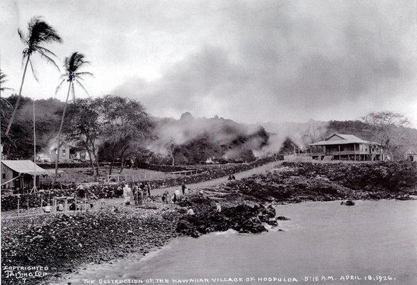
- April 18: Lava destroys Hoʻōpūloa village, including homes, churches, and the harbor.
- Late April: Eruption ends.
An estimated 42 people were displaced. Remarkably, USGS personnel were mapping the summit during the initial eruption.
U.S. Geological Survey
+1
One distinction about your dashed turquoise arrow: it shows the general southwestward trend correctly, but the initial summit lava and the destructive coastal flow did not necessarily form one continuous surface stream. Magma migrated underground to lower-elevation fissures, which then produced the destructive lava.
5. Your red pin: Today’s High Hit
Your marked location, approximately 19°25′23.8″N, 155°36′32.4″W, lies on or close to the summit’s southwest rift system.
The dark, nearly parallel streaks you can see extending downslope are characteristic of the overlapping lava flows, channels, and eruptive structures along this rift. However, satellite imagery alone cannot establish the age of every dark flow.
The square purple and brown patches across the left side are almost certainly differences between satellite-image tiles, rather than rectangular geological formations.
6. Why the alignment matters
Look at the geometry:
South Pit → Lua Hohonu → Lua Hou → your red pin → Southwest Rift Zone.
These features roughly follow a structural weakness extending away from the summit. Magma can exploit fractures along this zone, sometimes erupting at the summit and sometimes traveling substantial distances underground before reaching the surface.
The 1926 eruption is an excellent demonstration of this process.
My biggest takeaway from your image: Although the surface appears ancient and motionless, parts of it were constructed or substantially modified just 77–100 years ago. On geological timescales, that is essentially yesterday.
For further examination, two unusually useful resources are the USGS 2026 centennial account of the 1926 eruption and the detailed geological mapping of the summit features.
The second contains a particularly relevant map showing South Pit, Lua Hohonu, Lua Hou, and lava units from different eruptions—almost exactly the region you’ve captured.